

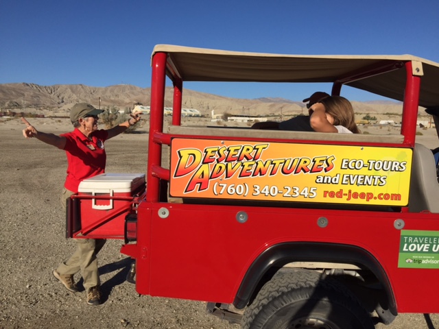
We took our 10-year-old daughter on a jeep tour to learn about the San Andreas Fault. Our informative guide De Karlen picked us up in her open air red jeep at the La Quinta Resort for an illuminating three-hour journey. We cruised for 20 minutes through La Quinta and Indio before reaching our off-road destination, while De entertained us with several fascinating stories about the desert. We learned:
- The North to South streets are named after American Presidents – Washington, Jefferson, Monroe, Jackson, Harrison and Tyler.
- During the summer, the population is about 150,000 people. In high season – winter and spring, the population explodes to 600,000 people with tourists, short-term visitors, and snowbirds arriving from Washington, Oregon, Canada, Arizona, Utah and soon New York.
- In January 2016, there will be nonstop flights from New York to Palm Springs. The new flights will run daily from Thursday through Monday from Jan. 14 to May 1. Seats are already on sale, with one-way fares starting at $99 between John F. Kennedy International Airport (JFK) and Palm Springs International Airport (PSP). This is when the weather is idyllic. In the summer, the temperature can be over 100 degrees for at least 125 days.
What I appreciated most about this tour is De taught us to look at the desert differently. “It isn’t just beige in color, but filled with beautiful pinks, yellow, greens, blues, browns and cream colors,” said De.
Outdoor Classroom
- We learned there are 9 cities in the Coachella Valley that run along Highway 111 – Cathedral City, Coachella, Desert Hot Springs, Indian Wells, Indio, La Quinta, Palm Desert, Palm Springs and Rancho Mirage.
- The Sonoran desert is 7% of the Earth’s surface. It’s a 140,000 sq. mile low desert that covers southwestern Arizona and southeastern California, as well as most of Baja California and the western half of the state of Sonora, Mexico. Irrigation has produced many fertile agricultural areas, in the Coachella valleys to the Salton Sea that is 227 feet below sea level.
- There are three water sources – Aquifer, Colorado River and Reclaimed Water.
- The San Andreas cuts through the valley, as the North American Tectonic Plate interacts with the Santa Rosa and San Jacinto mountains, forming the eastern edge of the Pacific Tectonic Plate (also known as The Ring of Fire). This zig zags northwest toward the Bay Area.

In the jeep we traveled on three different types of land that you can only explore on this Adventure tour – Federal, Private and 1862 Homestead Act.
Survival –
The Cahuilla lived here due to the great variety of plant and animal foods. De took us to a grove of California fan palms. The Cahuilla used the palm fruit for food and the leaves to make baskets, sandals, and roof thatching for their dwellings. She had us taste the salty silvery-whitish-gray shrub called Desert Holly. The Cahuilla used the white powder as a sunscreen.
We learned the Arrow Root weed is part of the sunflower family. It’s long straight stems were used as arrows.
She picked honey mesquite for us to crunch and taste the sweetness that was similar to caramel with a nutty flavor. It grows rapidly and produces dense shade when the water table is high. Animals and humans like to eat the honey mesquite seed pods. The Cahuilla used the firewood to stay warm. They also ground the Mesquite flour to make cakes. This flour offers protein and carbohydrates.

Geology
We learned about the Igneous, Sedimentary and Metamorphic rocks. De pointed out a fault gouge made of very fine and small grain size rocks formed by tectonic forces. We explored a replica of a Cahuilla Village, before walking on the San Andrea Fault and hiking into a beautiful narrow slot canyon. This geologically exotic area offered canyons and low mountains displaying minerals deep in the Earth. De told us this area was formed over time from erosion of wind and water. The iron-based minerals form desert washes of red, lilac, orange, coral, and burnt sienna.
As we drove back to our resort after sunset, an almost full moon softly lit the canyon. This scenery was an “awe” moment.
Natures Gifts
De was very dear to our daughter, as she collected plants for our daughter to take back to her class to share. She found some great rocks to take home and gave her an arrowhead. With a cooler of bottled water on the back of her jeep, she kept us hydrated in the dry desert air. After exploring the slot canyon, she pulled out a container of plump Medjool dates as a treat. Since we raved about the dates, she recommended we visit the Shields Date Garden for lunch the following day and sample many of their vast variety of dates and baked goods.
This Adventure Tour was the highlight of our three days in the greater Palm Springs area. Learning about the land in such a fun, outdoor classroom setting, actually made me less scared of earthquakes. As Sir Francis Bacon once said – Knowledge is Power. We can’t control when or where “the next Big One will hit,” however now we have a better understanding of what and why it is happening.
